

OldMapsOnline - History & Maps
Klokan Technologies GmbH
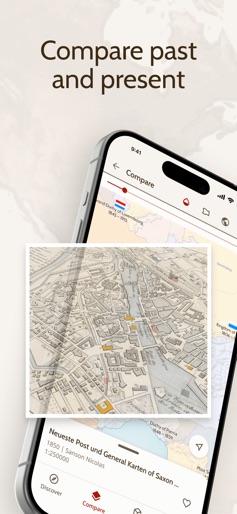
Create Screenshots Like OldMapsOnline - History & MapsApp Store Screenshots (10)


Design Analysis
Visual Design
Style: Custom
Key Features Shown
- •Interactive Timeline
- •Historical Region Highlighting
- •Biographical Overlays (Rulers/People)
- •Map Catalog List
- •Search and Discovery
App Insights
Target: History buffs, genealogists, students, academic researchers, and cartography enthusiasts.
- •In-app purchases
- •Subscription for ad-removal
- •Ad-supported
ASO Keywords:
About OldMapsOnline - History & Maps
Unveil history with OldMapsOnline: explore 500,000+ maps, journey through time with our interactive timeline, and discover the world's evolving landscapes and stories. Step into the past with OldMapsOnline, the ultimate iOS app for history enthusiasts and curious minds. Discover a treasure trove of historical maps that reveal the stories of our world like never before. Key Features: Vast Collection of Historical Maps: Access over 500,000 high-resolution scanned maps from prestigious cultural institutions. Explore detailed maps from various eras and see how geographical and political landscapes have changed over time. Interactive Map with Timeline: Dive deep into history with an interactive map that features a dynamic timeline. Select any year and watch the map transform to reflect historical data, showcasing the evolution of political boundaries and significant events. Overlay and Compare Maps: Gain a unique perspective by overlaying historical maps onto modern maps. Use our compare tool to see the transformation of cities, regions, and landscapes across centuries. Community-Driven Collection: Join a growing community of history enthusiasts who contribute to the largest online collection of old maps. Share your discoveries and help uncover the hidden stories within these maps. Seamless Wikipedia Integration: For those eager to learn more, our app offers integrated information from Wikipedia, providing a gateway to extensive historical content and deeper research. Intuitive Search by Location: Effortlessly find old maps by zooming and panning on a world map, or simply type in a place name. Utilize the timeline to explore different years and watch the map update with historical boundaries. Convenient Browser Extension: Easily add historical maps found on the web to the OldMapsOnline collection with our browser extension, expanding the richness of our database. Embark on a Journey Through Time OldMapsOnline offers powerful tools to visualize history, including a 3D terrain view, augmented reality features, and advanced catalog search. Whether you're a historian, student, or an explorer of the past, our app makes it easy to delve into the rich history of any location. About OldMapsOnline Created by a dedicated team of cartographers, historians, and volunteers, OldMapsOnline is a collaborative project that harnesses the latest technology to make historical maps accessible to everyone. Our partners include renowned institutions like the British Library, ETH Zurich, and the David Rumsey Collection at Stanford. Download OldMapsOnline today and start your journey through the world's history, one map at a time!
Create screenshots like OldMapsOnline - History & Maps
Use FlyerBanana's free editor to create professional App Store screenshots inspired by OldMapsOnline - History & Maps's design. 100+ templates, device frames, and one-click export.