

App Store Screenshots (10)


Design Analysis
Visual Design
App Insights
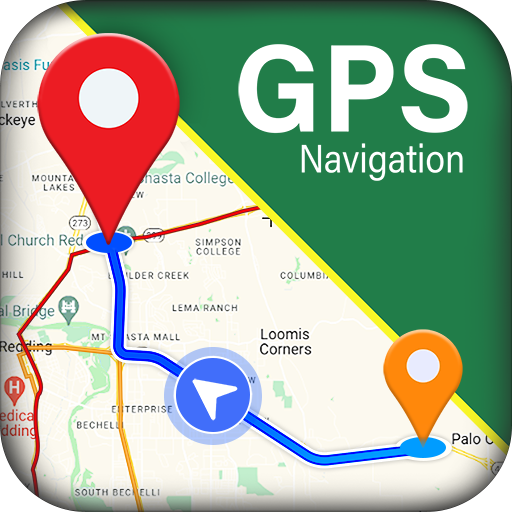
About onX Hunt: GPS Hunting Maps
Plan your hunt and find more success in the field. View species distribution, 3D maps, hunting units, and more. Whether you’re a private or public land hunter, know where you stand with nationwide land boundaries. Maximize your hunting experience with onX Hunt. Understand the landscape with satellite, lidar topo, and hybrid Basemaps. Save Offline Maps, view terrain, and mark crucial locations with Waypoints. Research property lines, monitor optimal weather conditions, and find new opportunities nationwide. Identify new areas to hunt by targeting nutrient-rich soil with our Historic Wildfire Layer. Integrate onX Hunt with compatible tools. View Trail Cameras for recent activity, display routes on your vehicle dash, and sync industry-leading rangefinders and binoculars with the App. Access custom Map Layers, including data on wildlife distribution, trees, crops, or soil. Access a GPS hunting app and navigate directly from your phone, or instantly drop a Waypoint from your wrist using Apple Watch. Share Map Markups with nearby devices on the same platform, even without service. Keep your hunt safe, organized, and efficient. Discover new access, find more game, and hunt smarter with onX Hunt. onX Hunt Features: ▶ Public & Private Land Boundaries • Access land boundary data and property line maps with landowner names (U.S. only)* • Identify public land with Forest Service, BLM maps, Timber Lands, and more • View GMUs, Hunting Units, county, and state land hunting maps * Private land ownership maps may not be available for all counties (U.S. only) ▶ Offline Maps & Custom Layers • View 2D or 3D maps to understand terrain and visualize your hunt • Toggle between satellite, lidar topo, or hybrid Basemaps • Save detailed Offline Maps with your Layers, Markups, and Waypoints • Use Map Layers to understand wildlife, tree, crop, and soil data ▶ Hunt Planner & Tracker • Add Markups, measure Line Distance, and calculate Area Shapes • Monitor Weather and set Optimal Wind conditions on any Waypoint • GPS hunting app. Log your hunt, monitor duration, distance, and speed • Scout from the comfort of your home with online Desktop Maps ▶ Integrated Hunting Tools • Display your custom maps and navigate hands-free with Apple CarPlay • Sync compatible rangefinders and binoculars to drop Waypoints automatically • Connect Moultrie trail cameras. See images in real time and receive key insights • Mark your location from your wrist using Apple Watch ▶ Free Trial Start a free trial for seven days when you install the app and select your state of choice. ▶ Premium Membership: One state, or Canada. Plan your hunt in a single state or Canada with land ownership maps, custom map layers, offline navigation, and more! ▶ Premium+ Membership: Two states, or one state plus Canada. With a Premium+ Membership, you get all the benefits of our Premium Membership, but for two states, or one state plus Canada. ▶ Elite Nationwide Membership: The best tool for the best hunters. With an Elite Membership, you get a complete, purpose-built solution for dedicated hunters and the game they pursue, including: • Proprietary maps for all 50 states and Canada • TerrainX 3D Viewer, Recent Imagery, Route Builder, Deer Movement Forecast • In-dash navigation with Apple CarPlay • Elite-exclusive pro deals and expert resources • Draw Odds and Application Tools ▶ Government Information & Data Sources onXmaps, Inc. does not represent any government or political entity, though you may find various links to public information within our services. For more info on any government information found within the services, click on the associated .gov link. • https://data.fs.usda.gov/geodata/ • https://gbp-blm-egis.hub.arcgis.com/ • https://www.arcgis.com/home/group.html?id=00f2977287f74c79aad558708e3b6649#overview ▶ Terms of Use https://www.onxmaps.com/tou ▶ Feedback Have a problem or want to request new features? Please contact us at support@onxmaps.com
Create screenshots like onX Hunt: GPS Hunting Maps
Use FlyerBanana's free editor to create professional App Store screenshots inspired by onX Hunt: GPS Hunting Maps's design. 100+ templates, device frames, and one-click export.
More Maps Apps
View all

The Weather Channel - Radar
Maps


Waze Navigation & Live Traffic
Maps


inDrive. Rides with fair fares
Maps


PlugShare: Charging Stations
Maps


MAPS.ME: Offline maps GPS Nav
Maps

GPS Navigation & Map Direction
Maps